0 Results for ""

Well data, production and rigs, in one view.
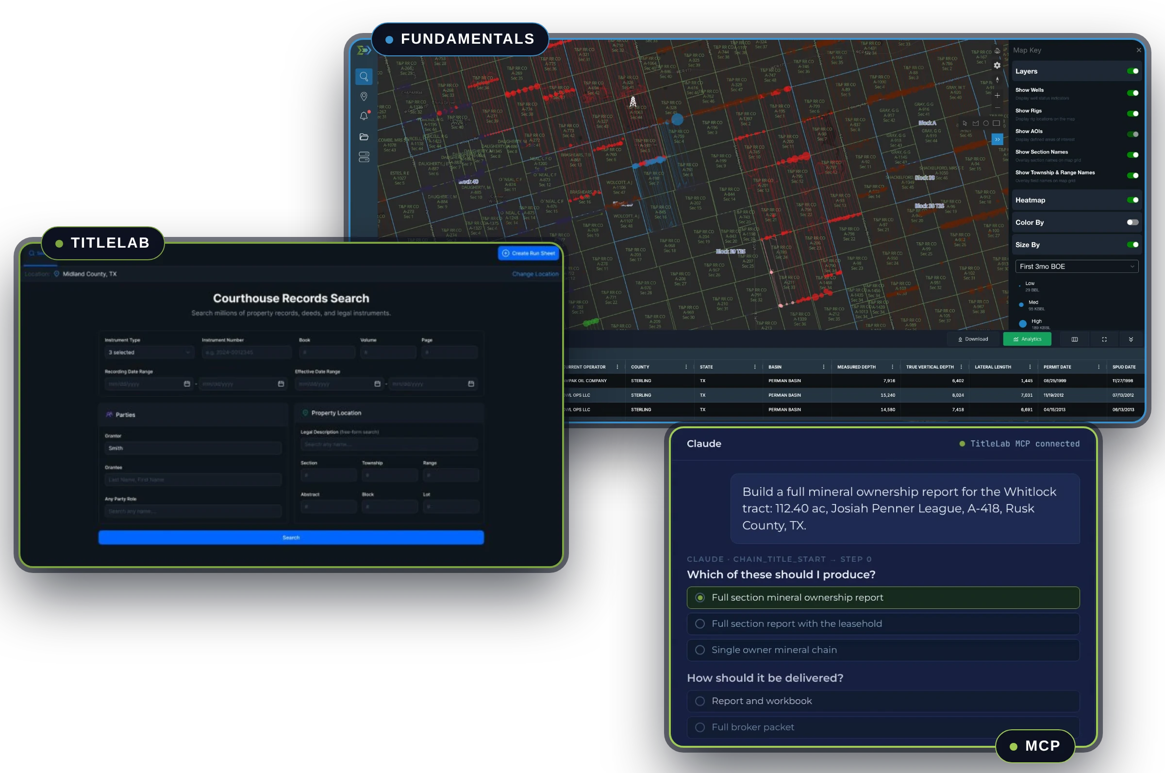
Fundamentals is Energy Domain’s core subscription: well data, production allocations, rig tracking, permits and AOI monitoring across the basins you work in. Start on the map, apply filters, and move from basin screening to well-level detail without leaving the view.
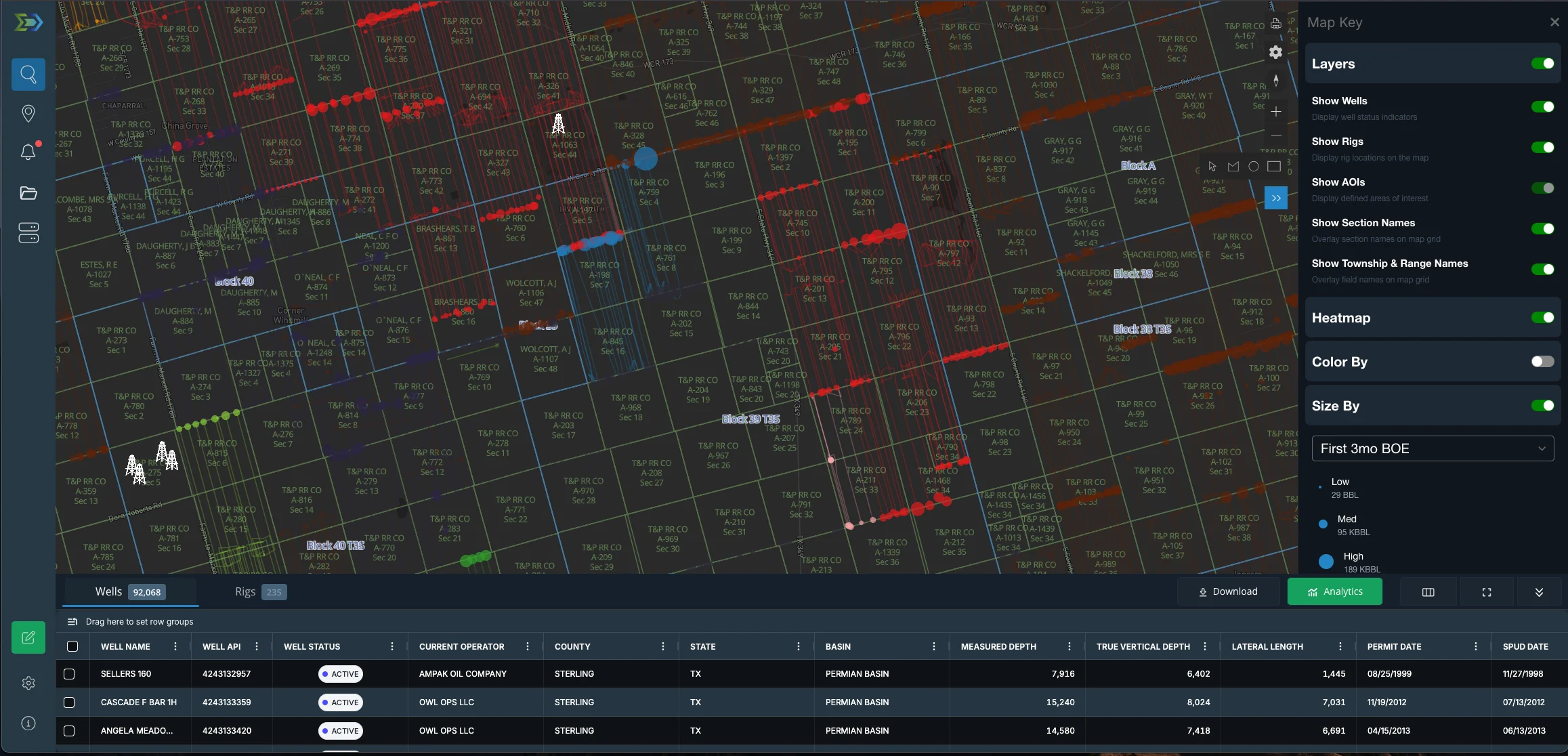
Trusted by operators, non-op buyers, mineral aggregators, and A&D advisors across the upstream market.






One record per well, and the context around it
Validated, normalized upstream datasets tied to confirmed API numbers. Choose counties, basins, or nationwide.
Wells
- Well Header DataThe foundational record for every well in your area of interest.
- Directional SurveysFull lateral path visibility for every horizontal well with a filed survey.
- Confirmed IntervalProprietary identification of each horizontal well’s primary landing zone.
- SpacingLeft/right neighbor detection with spacing classification for every horizontal well.
- Operator & Reservoir AliasingUnified naming across inconsistent state and operator reporting.
Production
- Production DataMonthly oil, gas, and water volumes, exactly as reported by the states.
- Allocated ProductionWell-level production estimates built on volume conservation and empirical well test data.
- Water ProductionWell-level water production estimates derived from test-based ratios and allocated hydrocarbon volumes.
- EUR ForecastsIndividual well-level liquids, gas, and water EURs from our proprietary forecast engine.
Activity
- Rig ActivityDaily rig position updates sourced from drilling contractors and satellite imagery.
- Pre-PermitsSee where operators plan to drill before permits are officially approved.
- FracFocus CompletionsFull FracFocus data integration for completion tracking on every stimulated well.
Land and map context
- Appraisal DataAnnual Texas mineral appraisal values and tax rolls, joined to well and lease records at no additional cost.
- Texas survey layers11 survey layers: abstracts, blocks and sections, leagues and labors, tracts and lots.
- AOI AlertsA daily email digest when new permits, rigs, DUCs, or active wells appear inside your boundaries.
Same data, four different questions
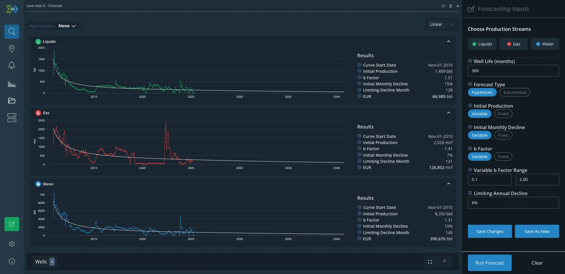
What will a well here make, and how confident can I be?
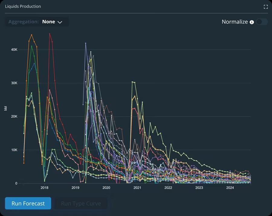
- Filter offsets to one Confirmed Interval, a tight area and a vintage window.
- Compare 6- and 12-month volumes per effective lateral foot, with parent and child neighbors tagged.
- Fit the type curve in the app, then export to Aries or PHDwin.
The teaser just landed. Is the seller’s story true?
- Map the seller’s footprint by well status, catching operator name variants.
- Check the production base and the seller’s recent wells per foot against fair offsets.
- Look at rigs, permits and DUCs to see whether they are investing or harvesting.
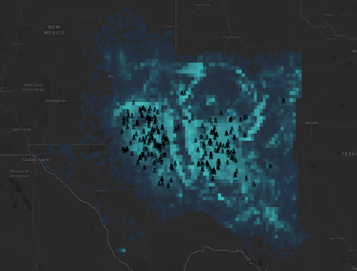
What is happening on and around my acreage?
- Draw an AOI on the map, or upload a shapefile of your tracts.
- Get a daily email digest when new permits, rigs, DUCs or active wells appear inside it.
- Check well-level allocated production and Texas appraisal data on the wells that matter.

Are we keeping up with the operators around us?
- See current rigs by operator and drilling contractor.
- Rank permits and new wells over the last 12 months.
- Benchmark productivity per foot against peers in the same interval.
Ask Fundamentals in plain English
Connect Claude, or the AI model of your choice, and ask questions in plain English against the exact same data that sits in the app. Answers come back as tables with API numbers, so every figure traces to a well you can open.
- Open the MCP setup page in the app.
- Grab your connection details and add them to Claude or another MCP-compatible model.
- Ask the question you’d otherwise build a spreadsheet for. You’ll be running in a couple of minutes.
Connect TitleLab too, and your AI cross-references wells and county records in a single conversation. If MCP isn’t in your subscription yet, reach out to sales to get it added.
How Energy Domain MCP works →Here are the five counties with the most active rigs today.
| County | State | Active rigs |
|---|---|---|
| County A | NM | 48 |
| County B | TX | 41 |
| County C | NM | 36 |
| County D | TX | 29 |
| County E | TX | 24 |
Each rig comes back with its operator, drilling contractor and location source.
Top five shown. The full list comes back as a table you can export.
| Rank | Operator | Permits filed |
|---|---|---|
| 1 | Operator A | 212 |
| 2 | Operator B | 187 |
| 3 | Operator C | 154 |
| 4 | Operator D | 133 |
| 5 | Operator E | 118 |
Every permit carries its API number, so each count can be checked.
Same Confirmed Interval, county and well type. Per-foot values use effective lateral length.
| First production | Wells | P50 12-mo oil (bbl/ft) |
|---|---|---|
| 2023 | n = 64 | 14.2 |
| 2024 | n = 71 | 13.6 |
Every well in each cohort is listed by API number.
Or bring the data to the tools you already use
Why the numbers hold up in a review
Rig positions, sourced daily
65% of rig positions sourced directly from drilling contractors. The rest from satellite imagery. 94 to 99% coverage compared to Baker Hughes.
Rig data methodology →Allocations you can audit
Well-test-driven production allocations for Texas and Louisiana. Lease-level volumes broken into well-level estimates with volume conservation and transparent methodology.
Allocation methodology →Landing zones from the surveys
Confirmed Interval identifies each horizontal well’s primary landing zone from its directional survey. New horizontal permits get one before the survey is filed.
About Confirmed Interval →Questions teams ask before they subscribe
Can I subscribe to just the counties I work?
Yes. Choose counties, basins, or nationwide, and manage everything in the app. No enterprise contract required.
How often is the data refreshed?
It depends on the dataset. Core state-reported production and well headers update on each state agency’s reporting schedule. Well statuses are event-driven and update daily. Rig locations update daily. Derived datasets, like production allocations and Confirmed Intervals, re-run as new well tests and state records arrive.
Does Fundamentals show who owns the minerals?
Fundamentals includes Texas mineral appraisal rolls, joined to well and lease records. An appraisal roll tells you who the county is taxing, not who holds record title. When you need the conveyances behind an owner, that’s what TitleLab is for.
Is there an API?
Yes. DataStream Direct is our JDBC connector, with a Python library and Snowflake support. MCP connects Claude and other AI models to the same data.
See Why Industry Leaders Choose Energy Domain
Pick an area you know well, a question you’ve had to answer recently, or a basin you actively monitor. You’ll know in minutes whether Energy Domain fits how your team operates.
© 2026 Energy Domain · Fort Worth, TX
