For Texas E&P teams
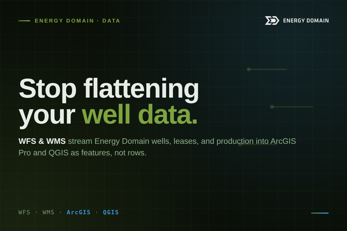
Your geologists, GIS analysts, and land teams work map-first. So why does every dataset still arrive as a spreadsheet you have to re-import, re-project, and re-join? Energy Domain's WFS and WMS endpoints stream wells, leases, and production straight into ArcGIS Pro and QGIS as features, not rows.
A Texas E&P team thinks spatially first. Where are the wells, whose acreage is that, what's the offset doing, where's the rig headed next. The questions are about position before they're ever about a number in a cell.
But most upstream data still arrives shaped for a spreadsheet or a SQL table. So the work begins with a tax: export the CSV, re-project it into your coordinate system, re-join it to the well it describes, and re-symbolize it, every time the data changes. Multiply that across the Midland and Delaware Basins, the Eagle Ford, the Barnett, and a dozen AOIs, and the people doing it are usually your most expensive technical staff. The map was the point, and they spend their day getting data onto it.
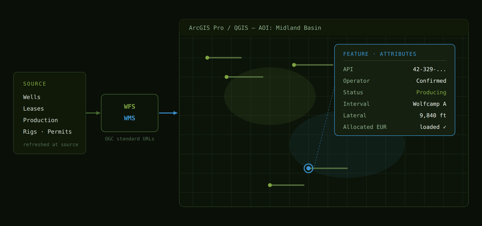
Energy Domain's Web Feature Service (WFS) and Web Map Service (WMS) endpoints remove that step. Your well, lease, and production data streams directly into your GIS as map-native objects. Open the project, add the connection, and the wells are already on the canvas.
What WFS and WMS actually do
WFS serves each well as a queryable feature with its full attributes attached. Select it on the map and the entire record comes with it, ready to symbolize, filter, and run geoprocessing against, right inside ArcGIS Pro or QGIS. It is the well, not a screenshot of the well.
WMS serves a pre-rendered, styled map layer for visual context. Drop it under your AOI as a reference layer or basemap when you want the picture without pulling every feature.
Both connect over open OGC standards through standard URLs: no plugins, no custom drivers, no IT tickets. Connect once, and the layer stays current as Energy Domain refreshes the source, so the map your team opens next quarter reflects today's operator activity, not a stale extract someone saved to a shared drive.
Who on a Texas E&P team uses it
GIS Analysts load Energy Domain wells as a live feature layer in ArcGIS Pro or QGIS, then run spatial selections, buffers, and joins against your proprietary acreage and infrastructure data, without standing up a new import pipeline first.
Geologists layer production heatmaps and well features beneath their own play maps to evaluate offset performance, formation trends, and analog wells across the Permian or Eagle Ford, without exporting a single CSV.
Land & A&D Teams symbolize wells by operator, vintage, or status across an AOI and overlay their lease, unit, and tract layers for diligence and screening: the operator picture and the ownership picture in one view.
Engineering Teams pull WFS features into geoprocessing pipelines (FME, ArcGIS ModelBuilder, custom Python) to automate reporting and keep downstream models in sync with current activity instead of last month's download.
Why it matters for a Texas operator
The payoff isn't a flashier map. It's that the most current well, lease, and production picture finally lives where your decisions already happen, and stays there. No version drift between the analyst's export and the geologist's project. No re-import the morning of a screening meeting. Access is scoped to your subscription geography, so the layer reflects exactly the basins you work.
And it isn't an upsell. WFS and WMS are included with every Energy Domain Data subscription at no additional cost. It is the same data you already license, now addressable from inside the tools your team lives in.
Capabilities at a glance
- WFS endpoint serving each well as a queryable feature with full attributes
- WMS endpoint serving pre-rendered, styled map layers for visual context
- Native compatibility with ArcGIS Pro, QGIS, ArcGIS Online, and any OGC client
- No plugins, no custom drivers, no IT tickets; connect via standard URLs
- Symbolize, filter, and run geoprocessing on Energy Domain features in your GIS
- Authentication scoped to your subscription geography
- Layers stay current as Energy Domain refreshes the source
- Included with all Data subscriptions
The short version: If your team works in ArcGIS Pro or QGIS, Energy Domain's wells, leases, and production can be on your canvas in minutes: live, scoped to your geography, and already included in your subscription.
See the data in your area
Pull production, track rigs, build type curves, and put Energy Domain wells on your own GIS canvas, scoped to the Texas basins you work.
- Get started: https://data.energydomain.com/sign-up
- Request a demo: https://www.energydomain.com/demo
- Full WFS & WMS overview: https://www.energydomain.com/data/web-feature-service