We're excited to share what we've been working on. This release includes some major new data sources, usability improvements based on your feedback, and continued progress on our biggest data processing initiatives.
What's New
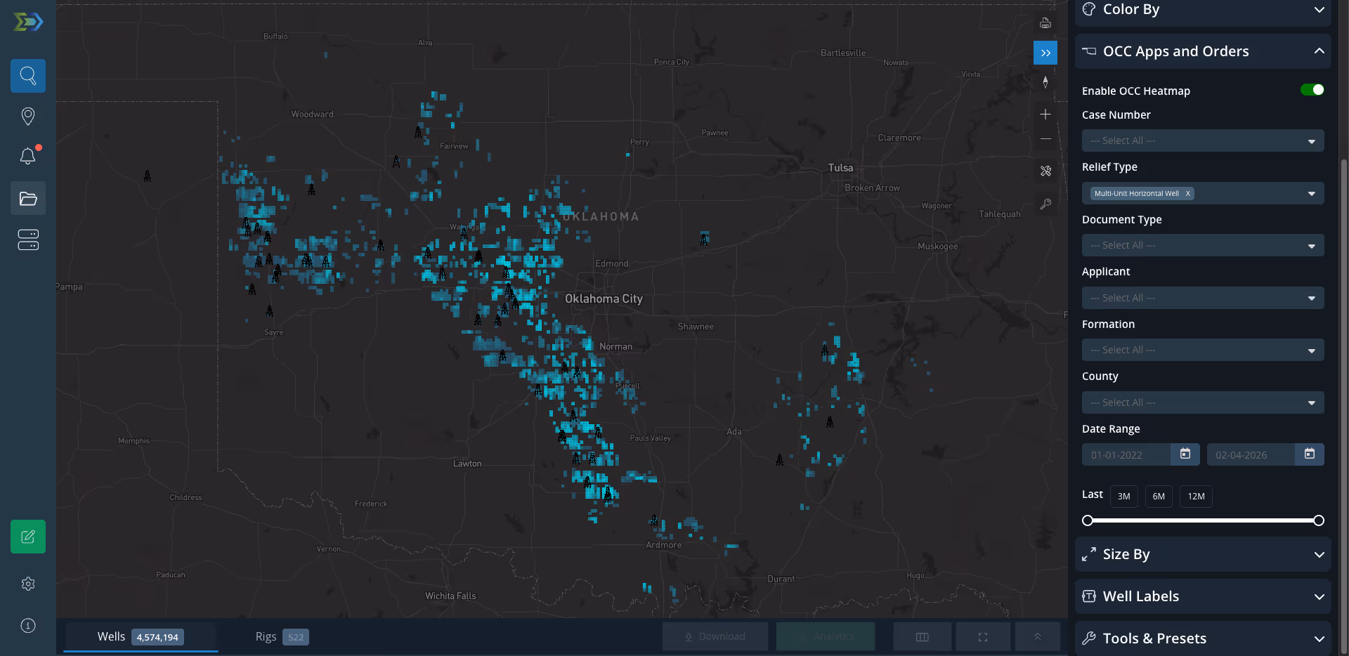
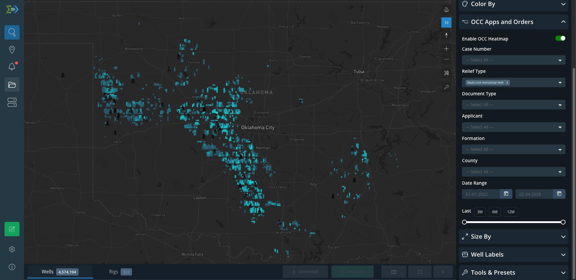
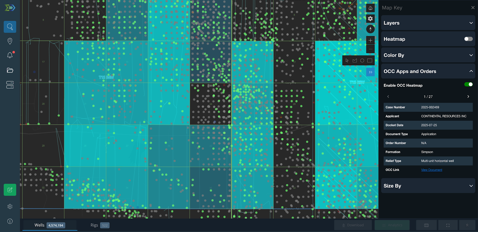
Oklahoma Corporate Commission Applications & Orders
This is a big one for our Oklahoma users. You can now view Oklahoma Corporate Commission applications and orders directly in the map - no more bouncing between systems or digging through the OCC website.
Our first release includes Multi-Unit Horizontal Well application types, with Forced Pooling and Spacing application types coming soon. Configure and save the layer in Map Settings, then use the Map key to check out application and order details. We've also included direct links to the source documents so you can verify everything straight from the source.
This should save you a ton of time if you're working permits or tracking regulatory activity in Oklahoma.
Directional Surveys in DataStream Direct
You can now query and pull full 3D Directional Surveys straight from DSD. Check out the data dictionary for table and header details and start querying away.
U-Shaped Wells Get Their Own Classification
Based on high demand from users, we pulled U-Shaped wells out of the Horizontal classification and gave them their own well orientation category. This should make filtering and analyzing these specific well types much easier.
Enhanced Search Functionality
Wildcard search now works across all search fields. This means partial searches will return any results that contain your query anywhere in the field, with exact matches sorted first. This includes API searches.
Filter "Select All" got an upgrade. We moved it to the top of all filters and changed how it works - you can now search for terms and it'll return all matches using ilike search. It's way faster, too.
Bug Fixes
- Cleaned up a styling issue with date pickers
- Fixed the grid-to-wells transition that was a few zoom levels off
- Resolved an issue where downloading PDF or PNG maps with the legend wouldn't include the legend in the export
Want to See This in Action?
If you’d like to see how these updates fit into your workflow, we’re happy to walk you through them.
Schedule a quick demo to explore OCC applications on the map, directional surveys in DataStream Direct, and the latest workflow improvements tailored to how your team uses the platform.